

No Cruise Port
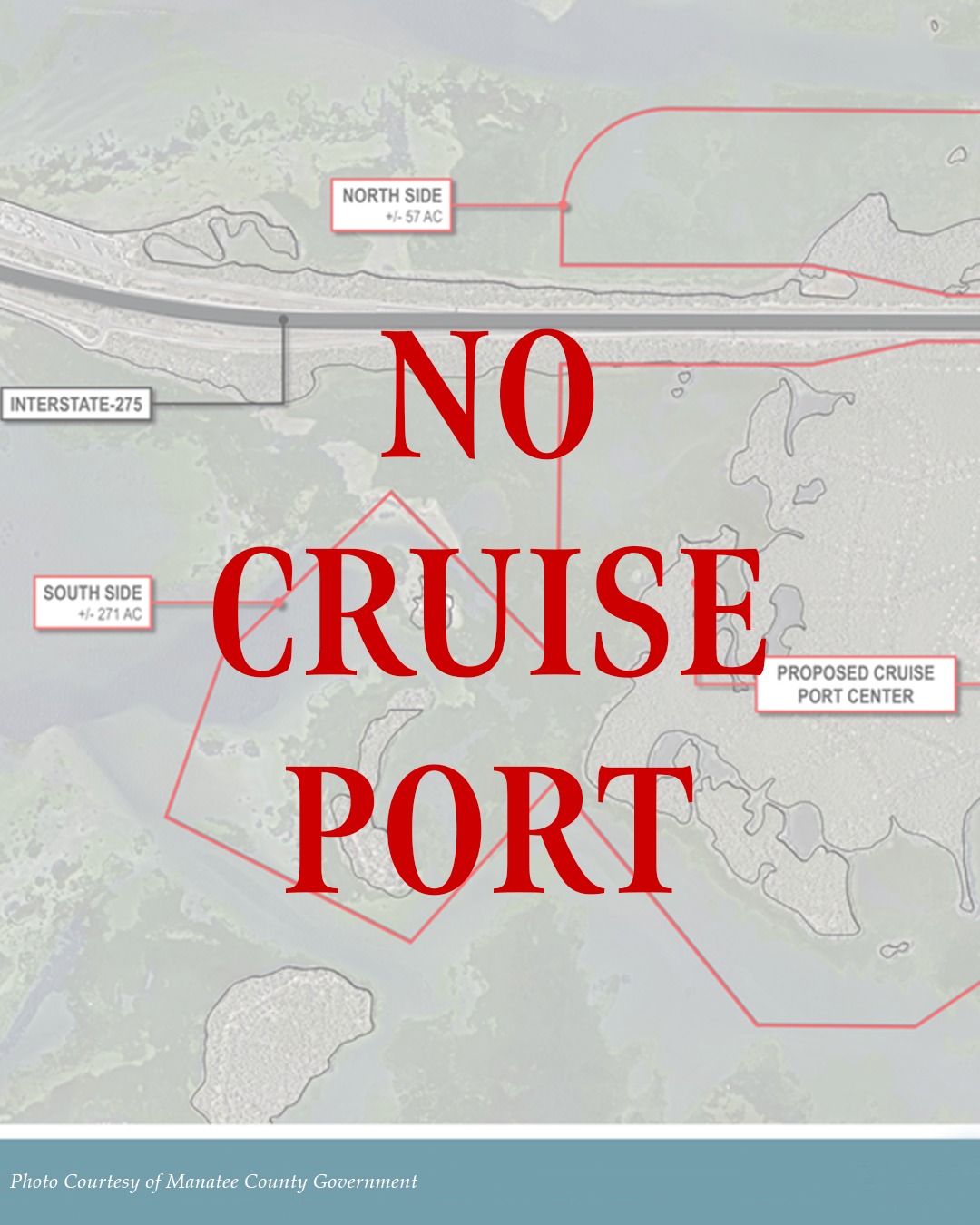
SSA Marine, in partnership with Slip Knott LLC, submitted a proposal to Manatee County to develop a cruise port in South Tampa Bay just north of Rattlesnake Key. The partners purchased a 328-acre parcel for the construction of the facility. The site borders a pristine, shallow-water ecosystem defined by thriving seagrass beds, mangrove habitat, and abundant game fish, one of the last largely untouched coastal areas remaining in greater Tampa Bay.
The proposal includes dredging waters north of Rattlesnake Key, removing mud, sand, and seagrass, and severely disrupting the surrounding estuary. This type of disturbance will degrade water quality, damage critical fish habitat and permanently alter the natural character of the area. The proposal is situated along pristine, shallow-water areas that feature lush seagrass, mangroves and game fish. The area of Miguel Bay and Rattlesnake Key are some of Florida’s best and most untouched areas within Manatee County.
CCA Florida, the state’s leading marine fisheries conservation organization with nearly 20,000 members, supports responsible access and sustainable use of Florida’s waters, but strongly opposes the commercialization of this sensitive habitat. We are committed to working with Manatee County and the State of Florida to prevent this project from moving forward and to ensure this area remains protected.
CCA Florida will continue to monitor the proposal, and we will keep our members notified with any further updates.
UPDATE – February 4, 2026
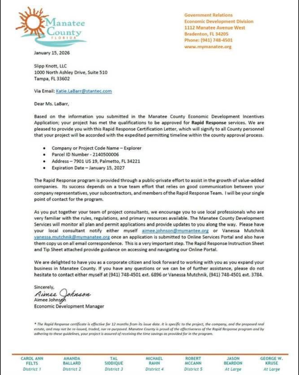
CRUISE PORT UPDATE! RAPID RESPONSE PERMITTING STATUS GRANTED
Manatee County has given the SSA Marine/Slip-Knott Cruise Port Proposal, code named Project Explorer, Rapid Response status for expedited permitting.
IMMEDIATE respectful and active communication with the Manatee Board of County Commissioners is needed, as Project Explorer is now part of a permitting process intended to move quickly.
Please read the Rapid Response letter in its entirety here: https://bit.ly/CruisePort1.
Contact the Manatee County Commissioners to urge opposition of the proposed cruise port! Commissioners contact info is listed below.
TAKE ACTION: Contact your Manatee County Commissioners:
Carol Ann Felts- carolann.felts@mymanatee.org
Amanda Ballard- amanda.ballard@mymanatee.org
Tal Siddique- tal@mymanatee.org
Mike Rahn- mike.rahn@mymanatee.org
Dr. Bob McCann- drbob.mccann@mymanatee.org
Jason Bearden- jason.bearden@mymanatee.org
George Kruse- george.kruse@mymanatee.org
UPDATE – February 19, 2026
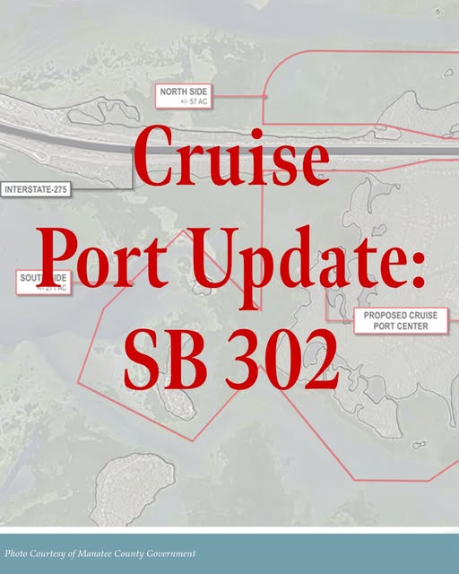
Update – February 19, 2026
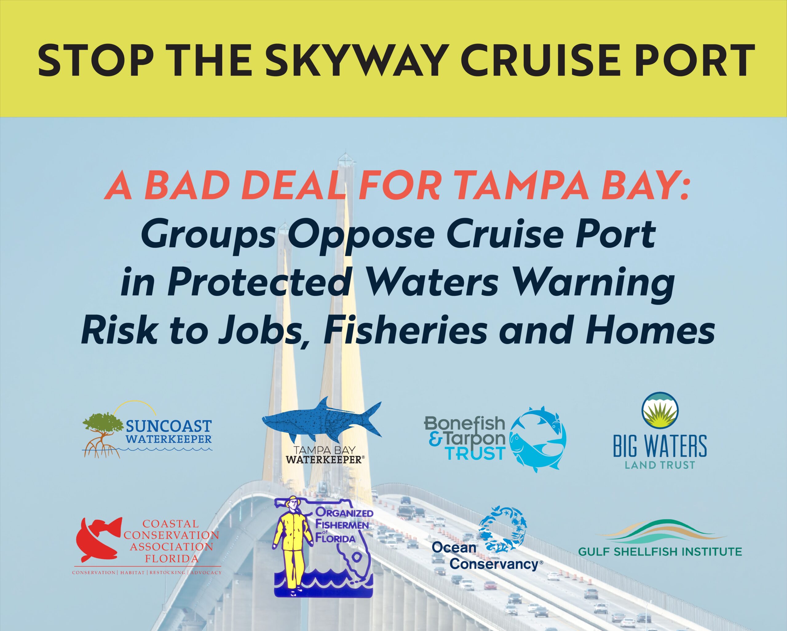
CCA Florida joins Suncoast Waterkeeper and fellow conservation organizations in opposition of the cruise port.
February 19, 2026
Florida Board of Trustees Internal Improvement Trust Fund
400 South Monroe Street
Tallahassee, Florida 32399
Dear Florida Board of Trustees of the Internal Improvement Trust Fund,
We, the undersigned organizations representing community, scientific, economic, and environmental interests, formally oppose the proposed multi-berth cruise terminal on the Knott-Cowen Tract, a privately held property within the geographic boundaries of the Terra Ceia Aquatic Preserve (TCAP). Our opposition is grounded in the preserve’s existing legal protections and legislative intent, its documented ecological significance and cultural heritage, and its established and ongoing economic importance to Tampa Bay and surrounding communities.
While the Knott-Cowen Tract is a privately held parcel and therefore not legally within the TCAP, it is sandwiched between the TCAP and fully contained within its geographic boundary. As a result, the waters and interconnected habitats within the TCAP’s geographic boundaries, including the Knott-Cowen Tract, have historically been treated as a single ecological system. Ecological surveys of birds, fish, and habitats have never been conducted or analyzed in accordance with legal distinctions within the preserve; instead, they reflect the integrated, continuous nature of the ecosystem as a whole.
Legal Protections and Legislative Intent
The Terra Ceia Aquatic Preserve was designated under the Florida Aquatic Preserve Act of 1975 to protect submerged lands of “exceptional biological, aesthetic, and scientific value…be set aside forever…for the benefit of future generations” (§258.36, F.S.). Management of sovereignty submerged lands within the preserve is subject to heightened scrutiny by the Board of Trustees of the Internal Improvement Trust Fund, reflecting legislative recognition that Florida’s submerged lands cannot support unlimited growth without degradation of water quality and habitat functions (Florida Department of Environmental Protection, 2019, p.6)
In addition, all aquatic preserves, including TCAP, are designated as Outstanding Florida Waters. This designation affords the highest level of water-quality protection under state law, such that no activity that degrades ambient water quality may be permitted unless it is clearly demonstrated to be in the public interest (Rule 62-302.700 F.A.C.). The Florida Administrative Code, which governs activities within aquatic preserves, restricts allowable uses of submerged sovereign lands. Specifically, these rules limit authorizations to structures necessary for water-dependent activities and require demonstration that no reasonable alternative exists outside the preserve for certain activities (Rule 18-20.004(1)(g), F.A.C.).
Manatee County’s Comprehensive Plan sets forth the principles, guidelines, standards, and strategies for the orderly and balanced future economic, social, physical, environmental, and fiscal development of the County, reflecting the community’s commitment to implement the plan and its elements. The proposed cruise ship port is fundamentally inconsistent with the Comprehensive Plan and its land use regulations.
The Knott-Cowen tract is located within the Coastal Evacuation Area (CEA), Coastal High Hazard Area (CHHA), and the Coastal Planning Area (CPA) overlay districts, which are legislatively controlled to minimize the effect of development, limit population, limit infrastructure, limit the magnitude of public and private loss of infrastructure to residents, accomplish shoreline stabilization by limiting development activity, protect coastal water quality by reducing impervious surface, and encourage and maintain vegetative and spatial buffer zones in mitigating the effects of storm surge and tidal velocity (Policy 2.2.2.4.1, Policy 2.2.2.4.2, Policy 2.2.2.4.4(a), Policy 2.2.2.4.5(a), Policy 2.2.2.5.1, Policy 2.2.2.5.2, Policy 2.2.2.5.3, Policy 2.2.2.5.4, and Policy 2.2.2.5.5). Conversion of the sensitive and ecologically significant Knott-Cowen tract, designating as RES to Industrial Heavy (IH), violates these and other numerous objectives and policies within Manatee County’s Comprehensive Plan.
Development of an industrial mega cruise port will put residents in adjacent communities, such as Terra Ceia, at undue risk of flooding, water contamination, storm damage, loss of life, and property loss. The evisceration of mangroves, other wetlands, seagrasses, and hardbottom habitat will remove the primary buffers protecting neighboring residents and their properties. Furthermore, compounding these losses are changes in water depth and a reduction in bottom roughness, which substantially increase the risk of flooding from storm surges (Familkhalili & Talke, 2016) and high tides (De Leo et al., 2022; Pareja‐Roman et al., 2023) to adjacent communities. Not only does Policy 2.9.2.3 explicitly prohibit industrial development within any residential designation, but industrial development at the proposed location is also subject to the sensitive and protected TCAP located within the CEA and CHHA districts, which development would have an irreversible impact on neighboring residential communities.
These statutory and regulatory frameworks reflect clear legislative intent: the area contained within the legal and geographic boundaries of the Terra Ceia Aquatic Preserve is to be conserved in the highest state, not converted. Furthermore, uses within the preserve’s geographic boundaries must be compatible with TCAP’s natural functions and long-term public benefit.
Ecological Significance of the Terra Ceia Aquatic Preserve
The geographic boundaries of the TCAP encompass approximately 21,736 acres of predominantly unaltered submerged and wetland habitats within Tampa Bay, including seagrass meadows, mangroves, salt marshes, tidal flats, live hardbottom, oyster bars, and clam beds (Florida Department of Environmental Protection, 2019, p. 14). These interconnected ecosystems provide essential functions that support diverse marine life, emblematic of a healthy and productive estuary. These habitats coexist in extremely shallow waters, with depths of approximately 1–3 feet immediately seaward of the Knott-Cowen Tract and less than 12 feet across most of the TCAP’s geographic boundaries. Only a very small portion of the area reaches depths of up to 18 feet (Florida Department of Environmental Protection, 2019, Map 5).
Biological monitoring demonstrates the area’s exceptional productivity. Since 1993, nearly 700 benthic species and 200 unique fish species have been documented in TCAP. Within the proposed project footprint alone, 88 species have been recorded, including 26 recreationally or commercially important species such as snook, spotted seatrout, red drum, gag grouper, gray snapper, blue crab, and pink shrimp, as well as seven species of sharks and rays and six species of seahorses and pipefish (Tampa Bay Estuary Program, 2026).
This diverse array of marine life would not exist without the lush 3,417 acres of seagrass beds within the preserve. Within the project footprint, there are an estimated 113 acres or 85 football fields of seagrass meadows. These seagrass fields function as underwater lungs, filtering water and providing a nursery for recreationally and commercially important fish species within the project footprint and beyond (Sarasota Bay Estuary Program, 2026). These seagrass areas also stabilize sediments and provide food for a wide range of marine species, including but not limited to the Florida Manatee (Florida Department of Environmental Protection, 2019, pp. 32, 42).
Mangrove forests and salt marshes occur throughout the aquatic preserve and within the proposed project footprint, where they play a critical role in nutrient cycling, shoreline stabilization, storm buffering, and the maintenance of complex interconnected habitat structure. Within the project footprint alone, approximately 122.6 acres of mangroves (more than 85 football fields) have been documented (Tampa Bay Estuary Program, 2026). According to the Habitat Master Plan for Tampa Bay, conserving all remaining mangrove areas is necessary to achieve regional water quality and habitat restoration goals (Robinson et al., 2020). The importance of mangroves to Florida’s marine ecosystems is well established. As recognized by the Florida Department of Environmental Protection, “Florida’s important recreational and commercial fisheries would drastically decline without healthy mangrove forests” (Florida Department of Environmental Protection, n.d.).
It is not just seagrasses and mangroves at risk; live hardbottom and shellfish resources, which support diverse biological communities and important fisheries functions, are within the proposed project area’s impact zone. Hardbottom areas, including oyster and clam beds, make up 4.5 acres (over 3 football fields) of the proposed cruise port site. These highly sensitive areas are the most vulnerable to sedimentation from dredging and land conversion.
The habitats defined within the geographic boundary of TCAP have been recognized by the Florida Department of Environmental Protection (FDEP) as “highly productive” for which “maintaining the [area] in a substantially natural condition” will “preserve and protect significant endangered and threatened species including the Florida manatee, roseate spoonbill (Platalea ajaja), little blue heron (Egretta caerulea), tricolored heron (Egretta tricolor), least tern (Sternula antillarum), snowy egret (Egretta thula), reddish egret (Egretta rufescens) and American oystercatcher (Haematopus palliates)” (Florida Department of Environmental Protection, 2025, p.3-5).
Together, these intact and highly productive natural systems form a critical foundation for coastal resilience and public safety in the greater Terra Ceia community. Recognizing their strategic importance, land within the TCAP’s geographic boundaries has recently been prioritized for conservation by Big Waters Land Trust due to its exceptional value in building coastal resilience. Big Waters identified this land as a priority site in its Conservation Plan based on its vital role in sustaining interconnected ecosystems and protecting nearby coastal communities. (C. Johnson, personal communication, February 14, 2026).
Economic and Cultural Importance and Existing Public Benefits
The Terra Ceia Aquatic Preserve and surrounding Tampa Bay habitats already provide substantial and ongoing economic benefits. Collectively, Tampa Bay’s natural systems generate more than $32 billion annually in economic output through tourism, fishing, boating, marine construction, and other bay-dependent industries. This means that one in ten regional jobs depends on a healthy bay. It also provides measurable ecosystem services, including carbon sequestration, nitrogen removal, and flood protection, worth hundreds of millions of dollars annually (Tampa Bay Regional Planning Council and Tampa Bay Estuary Program, 2023).
At the county level, marine commercial fishing in Manatee County generated approximately $7.1 million in sales revenue in 2019. Commercial fishing supported 273 jobs and provided livelihoods as well as social and cultural value not fully captured in revenue estimates (Camp et al., 2021). From 2020 through 2025, Tampa Bay alone accounted for 12% of the total weight of food and baitfish caught commercially in Florida (Florida Fish and Wildlife Conservation Commission, n.d.). Because Terra Ceia Bay is the last remaining natural area in the greater Tampa Bay region, it is reasonable to assume this area contributes significantly to the recorded landings.
Additionally, the epicenter of Tampa Bay’s commercial shellfish aquaculture industry resides within the TCAP and adjacent to the proposed cruise terminal project area. The largest shellfish hatchery in the Southeastern U.S, which supplies a significant portion of seed to the $43.3 million state-wide industry (United States Department of Agriculture, 2023), is located within TCAP and lies in close proximity to the impact area (<1 mi). The proposed cruise terminal on the Knott-Cowen Tract is also located within Tampa Bay’s only Shellfish Harvest Area (SHA), a state-regulated area monitored by the Florida Department of Agriculture and Consumer Services (FDACS) to ensure safe shellfish production. A total of 13 clam and oyster leases, operated by small, local, independent farmers, rely upon these especially clean waters for their livelihoods (Florida Department of Agriculture and Consumer Services, n.d.). Simply, Tampa Bay’s local shellfish aquaculture industry could cease to exist in its current form if a multi-birth cruise terminal is constructed at the proposed location. As bivalve shellfish are filter feeders, an impact on this industry not only means fewer jobs and less fresh from Florida shellfish, but also a decline in water quality.
Furthermore, habitats in and adjacent to the proposed port site are essential to sustaining tarpon populations and support a regional recreational fishery. According to the American Sportfishing Association, which tracks recreational fishing participation and expenditures by U.S. Congressional district, an estimated 364,140 anglers spent approximately $767 million on fishing-related purchases in the Tampa Bay region, encompassing Congressional Districts 14 and 16 (American Sportfishing Association, 2025).
The region’s economic benefits are directly tied to the ecological integrity of the Terra Ceia Aquatic Preserve. They are consistent with the preserve’s intended role as a long-term public asset.
The preserve also contains significant cultural resources. More than 40 pre-Columbian archaeological sites have been documented in nearby portions of TCAP, and at least one archaeological site is known to lie within the proposed project footprint (Tampa Bay Estuary Program, 2026). These resources further reinforce the preserve’s designation as an area warranting special protection.
Moreover, the Terra Ceia community is defined by the TCAP. Its natural beauty, bounty, and ecological significance have drawn a community together over the years and provided cherished experiences for generations of paddlers, anglers, and nature lovers.
Documented Risks Associated with Cruise Port Development within the Geographic Boundaries of the Terra Ceia Aquatic Preserve
Development of a multi-berth cruise port within the geographic boundaries of the Terra Ceia Aquatic Preserve would introduce substantial and well-documented risks to protected submerged habitats and water quality, primarily due to the scale of dredging and vessel activity required to accommodate modern cruise ships.
Dredging-Related Impacts
Construction of a cruise port would require dredging access channels to depths substantially deeper than current conditions. Current water depths in the area surrounding the Knott-Cowen Tract range from approximately 3 to 18 feet. Cruise vessels require significantly deeper navigation channels. As a result, wide and deep dredging would be necessary, directly destroying live hardbottom habitats and degrading adjacent hardbottom areas, seagrasses, and wetland habitats (Bonefish & Tarpon Trust, 2026). The potential dredging zone of impact alone could eliminate some of the most productive commercial aquiculture leases in the state, and the adjacent land-use change jeopardizes most, if not all, of TCAP’s Shellfish Harvest Areas available for farming (S. Hesterberg, personal communication, February 17, 2026).
Examinations from comparable projects demonstrate the potential scale of dredging impacts. Following dredging associated with the Port of Miami expansion (2013–2015), researchers documented increased partial mortality of corals up to 700 meters from the dredged channel due to dredging-induced sedimentation, with impacts likely extending between 5 and 10 kilometers (3 to 6 miles) from the dredge area (Miller et al., 2016; Cunning et al., 2019). Additional assessments of dredging-related impacts at Port Everglades identified risks to reef communities from sediment-bound contaminants released during dredging (Whitall et al., 2023).
Finally, changes in the estuary’s depth and bottom roughness resulting from dredging a shipping channel will compromise coastal resilience by increasing the frequency and severity of high tides and storm surges, posing risks to life and property. (Familkhalili & Talke, 2016; De Leo et al., 2022; Pareja‐Roman et al., 2023).
Seagrass Impacts
Seagrass communities within and adjacent to the proposed project site are exposed to both direct and indirect impacts from dredging and increased turbidity. Seagrass ecosystems, among the most endangered globally, are also among the most sensitive to anthropogenic disturbance (d’Avack et al., 2014; Schlacher-Hoenlinger & Schlacher, 1998). Dredging and associated turbidity harm seagrass by causing physical damage and long-term ecological effects, disturbing sediments, and reducing light availability for photosynthesis (Erftmeijer & Lewis, 2006). A seven-year study documented persistent declines in seagrass following dredging, with recovery timelines still uncertain, suggesting that impacts may be long-lasting if recovery occurs at all (Daniels et al., 2018).
Hardbottom and Fisheries Impacts
Within the Knott-Cowen Tract, direct impacts to live hardbottom habitat are estimated at 4.5 acres, with indirect impacts across the broader preserve currently unknown. Hardbottom substrate communities are highly vulnerable to destruction from siltation, fill placement, blasting, and damage from vessel traffic. They are also susceptible to contamination from heavy metals, oils, and pesticides, which can render consolidated substrates unsuitable for colonization by marine and estuarine flora and fauna, particularly in areas associated with major ports and shipping channels (Florida Department of Environmental Protection, 2019, p. 21).
These live hardbottom areas serve as an important migratory corridor and spawning habitat for adult tarpon. Dredging activities, combined with increased cruise ship traffic and other port-related operations, would significantly disrupt tarpon migration patterns and habitat use that are essential to the regional recreational fishery (Bonefish & Tarpon Trust, 2026).
Water Quality Degradation and Contaminant Resuspension
Dredging and port construction pose substantial risks to water quality through the resuspension of sediments. Increased turbidity presents an immediate physical hazard to benthic communities by reducing light penetration and smothering organisms. In addition, dredging can resuspend sediment-bound contaminants into the water column, increasing the potential for bioaccumulation.
Empirical studies demonstrate these risks. Bach, Nielsen, and Bollwerk (2017) documented that underwater blasting and dredging dispersed fine-grained sediments carrying heavy metals more than 350 meters (nearly one-quarter mile) from a construction site, resulting in the accumulation of bioavailable arsenic, cadmium, and lead in mussels at distances of 150, 250, and 350 meters from the source. Similarly, assessments of sediment contamination associated with Port Everglades identified ecological risks from heavy metals in port-adjacent sediments (Giarikos et al., 2023).
Conclusion
The geographic boundary of the Terra Ceia Aquatic Preserve represents a rare convergence of statutory protection, ecological productivity, cultural heritage, and economic value within Tampa Bay. The existing legal framework governing aquatic preserves and Outstanding Florida Waters reflects clear legislative intent to safeguard these resources from incompatible uses. Based on the preserve’s documented characteristics and protections, the proposed cruise port within TCAP’s geographic boundaries is inconsistent with all layers of local, state, and federal regulations that must protect this precious resource. The potential impacts further underscore the incompatibility of large-scale port infrastructure with the purpose, protections, and long-term public interest served by the Terra Ceia Aquatic Preserve and adjacent areas. We urge you to protect the environmental, cultural, and economic integrity of the Tampa Bay region by maintaining the exceptional quality of the interconnected habitats of Terra Ceia Aquatic Preserve.
back to florida news